Maps that work
where signal doesn't.

Built for search & rescue, disaster response, and field teams operating off-grid.

Drop POIs, log GPS tracks, draw coverage areas, and sync when you're back in range. No enterprise license. No failed downloads. No lost data.
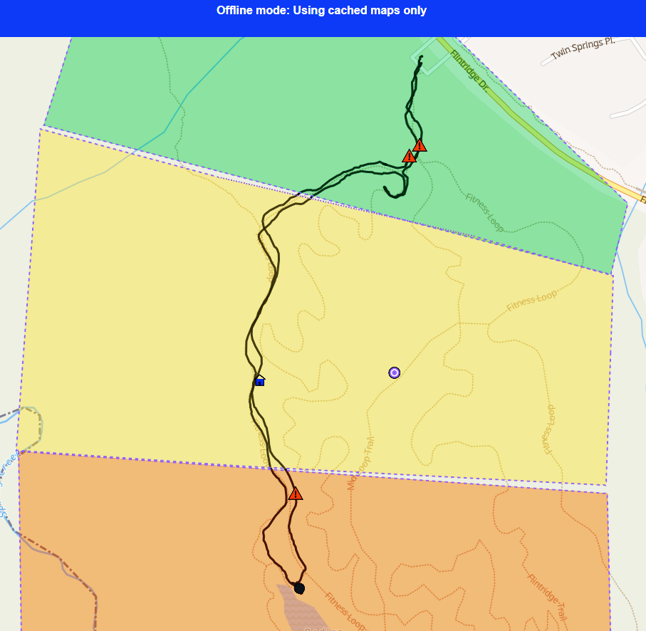
PWA β€” Any Device Works on 2G GPS Track Logging Zero Data Loss Tested in Texas field ops
BlocNav offline field mapping
Sector complete
Active search sector
Responder path
Hazard reported

Built for teams operating outside reliable coverage

πŸ” Search & Rescue 🌿 Environmental Survey ⚑ Utility Inspection 🚨 Disaster Response 🌾 Ranch & Land Mgmt

Everything your team needs in the field.
Nothing that breaks when you get there.

πŸ—ΊοΈ Offline Maps

Download map tiles by county. They stay on your device β€” no random failures, no re-downloading every time you go out.

πŸ“ Drop POIs Anywhere

Tap the map, add details and photos, save. Works with zero signal. Your data survives app close, phone reboot, or dead battery.

◻️ Coverage Tracking

Draw polygons to mark sectors β€” to search, active, or searched. See at a glance where your team has been and where they haven't.

πŸ”„ Conflict-Free Sync

Back in range? Tap sync. POIs, tracks, and coverage merge cleanly β€” no failed syncs, no orphaned records, no calling tech support.

πŸ›€οΈ GPS Track Logging

Record where your team actually went. Start a track, move through the field, stop when done. Distance, duration, and route β€” all saved offline.

πŸš— Driver Mode

One-tap hazard capture from a moving vehicle. Camera-first, GPS-tagged, auto-synced. Built for the person who can't stop to fill out a form.

πŸ“± No App Store. No IT.

Send a link. Open it. Install from the browser. Your team is live in under 60 seconds β€” on any phone, tablet, or laptop.

πŸ‘₯ Team-Ready

Everyone works from the same map. POIs, tracks, and coverage from the whole team merge into a shared view after sync.

Field mapping shouldn't require
an enterprise GIS license.

Built for teams who've tried ArcGIS Field Maps β€” and need something that actually works offline.

βœ•  Traditional tools
βœ“  BlocNav
Offline downloads fail randomly β€” even for small areas. Maps vanish from devices after days.
Download county tiles once. Integrity-verified. They stay until you clear them.
Sync fails silently. Edits get trapped on device with no recovery path.
Atomic batch sync with conflict-free merge. POIs, tracks, and coverage all make it to the server.
$1,500+/user/year. IT department required. Weeks to deploy.
Share a URL. Install the PWA. Deployed in minutes, not months.

Slow networks are worse than no network.

Most apps treat connectivity as binary β€” online or offline. In the field, you're usually somewhere in between: your phone shows bars, but nothing loads. BlocNav was designed for this "deceptive connectivity" β€” local data is always available first, and the system never blocks your maps waiting on a network that isn't really there.

Read the full technical breakdown β†’

Up and running in four steps.

01

Open the link

Visit the URL. Install the PWA from your browser. No app store needed.

02

Download your area

Select counties. Tiles download and verify automatically.

03

Work offline

Drop POIs, log tracks, draw coverage. Everything saves locally.

04

Sync when ready

Back in range? One tap. Team data merges into a shared map.

Ready to test it in the field?

BlocNav is in active pilot testing with field teams in Texas. If your team works in low-connectivity environments and needs mapping that actually works offline, let's talk.

contact@blocnav.com Tell us your use case β€” we'll set up a walkthrough.